Hikes we Like: Prairie View
Hikes we Like: Prairie View
This hike is a fairly easy 15-km loop that starts from the Barrier Dam parking lot. It is suitable for those looking for a half-day hike who are willing to drive about 15 minutes from Kananaskis Village. (On a bike, I would classify this as a third of a day). The trail is gentle with gradual elevation gain—300 m over 8 km.
To access the trailhead from Kananaskis Village, head back out to Highway 40 and go left (south) towards the Trans-Canada Highway. After about 15 minutes you’ll reach a sign that says Barrier Lake. Keep driving and turn at Barrier Dam, another few minutes down the road.
There are 11 switchbacks (count ’em) through the trees to the ridge.
The trail starts around the dam on the flat gravel path that circumnavigates the lake. At the other side of the lake, there’s a path that leads into the wilderness (AKA trees). Take it all the way (seriously, this feels like it goes on forever) under the power lines, through the meadow past the first intersection, and sign to the second one where the path crosses Stoney Trail (you’ll see a green signpost). Turn right, then take a pretty quick left that leads up the mountain.
There are 11 switchbacks (count ’em) through the trees to the ridge. Many paths shortcut the trail, but they’re steep and not well packed, so can be extremely slippery; I do not recommend these. There is also a path that leads off into nothingness on the right side of the trail; don’t take it.
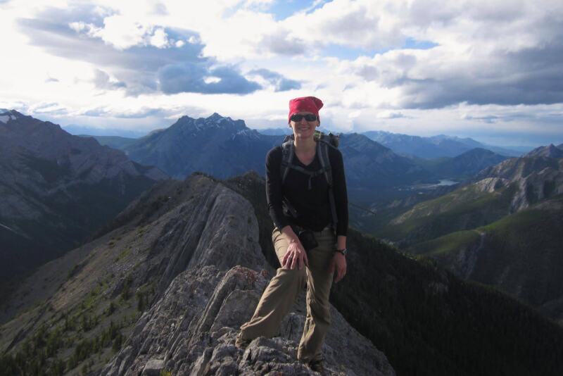
The trail continues and becomes a bit steeper, but that doesn’t last very long. You’ll hit a small, open resting spot where you can see mountains ahead and the lake beside you. The high point of the trail is a rocky outcrop with an awesome view back toward Barrier Lake and Mount Baldy. You can identify this point by the massive white metal square in the trees behind (I have no idea what it is).
This is the turnaround point for most people, as well as where Jewell Pass connects to the Prairie View trail. However, if you want to keep hiking to the lookout, it’s only another kilometer or so and 125 m elevation gain. Continue on the path to the right of the rock outcrop (if you came up Prairie View).
The trail begins indistinctly but becomes apparent further on. This section is considerably steeper than the first, as well as narrower and less clear, but is short and definitely doable. You may have to climb over rock slabs. As you get closer to the summit you’ll begin to see over the other side of the ridge. Mount Yamnuska, the highway, rolling prairies, and even the cement plant come into view and make a great photo opportunity.
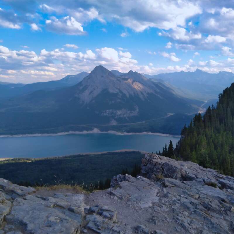
Enjoy a 360⁰ view of the mountains, lake and beautiful scenery in every direction.
You’ll pass some signs along the way that say “No firing guns” “Private residence ahead” and fun things like that. At the top is a small building where the fire lookout monitor lives, so please be respectful. There are multiple structures including a helipad that you can wander around.
Enjoy a 360⁰ view of the mountains, lake, and beautiful scenery in every direction. If you’re lucky you’ll meet the cute dog who lives with the current fire lookout monitor.
Heading back down the same way you came up, you can choose to take the same trail back or venture down Jewell Pass. I didn’t take Jewell Pass because a couple I ran into told me they had spotted a bear (bring your bear spray!) and being a lone hiker, I decided not to risk it.
If you’ve made it down to Barrier Lake early enough (before 5 and on the weekend), you can drive back to the Barrier Lake turnoff and enjoy one of our boat rentals—canoe, kayak or SUP. If it’s too late or you’re just exhausted, go back to the lake and relax on the beach as you admire the scenery.
Happy hiking!
Latest Stories
Summer Tours
Winter Tours
Like this article? Share!